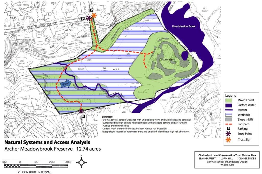
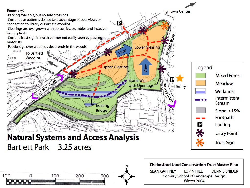
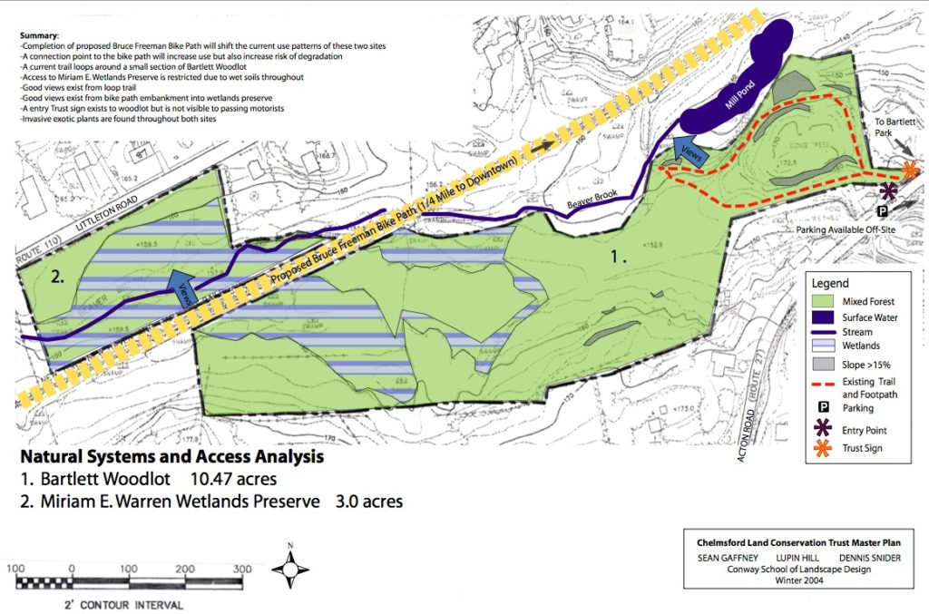
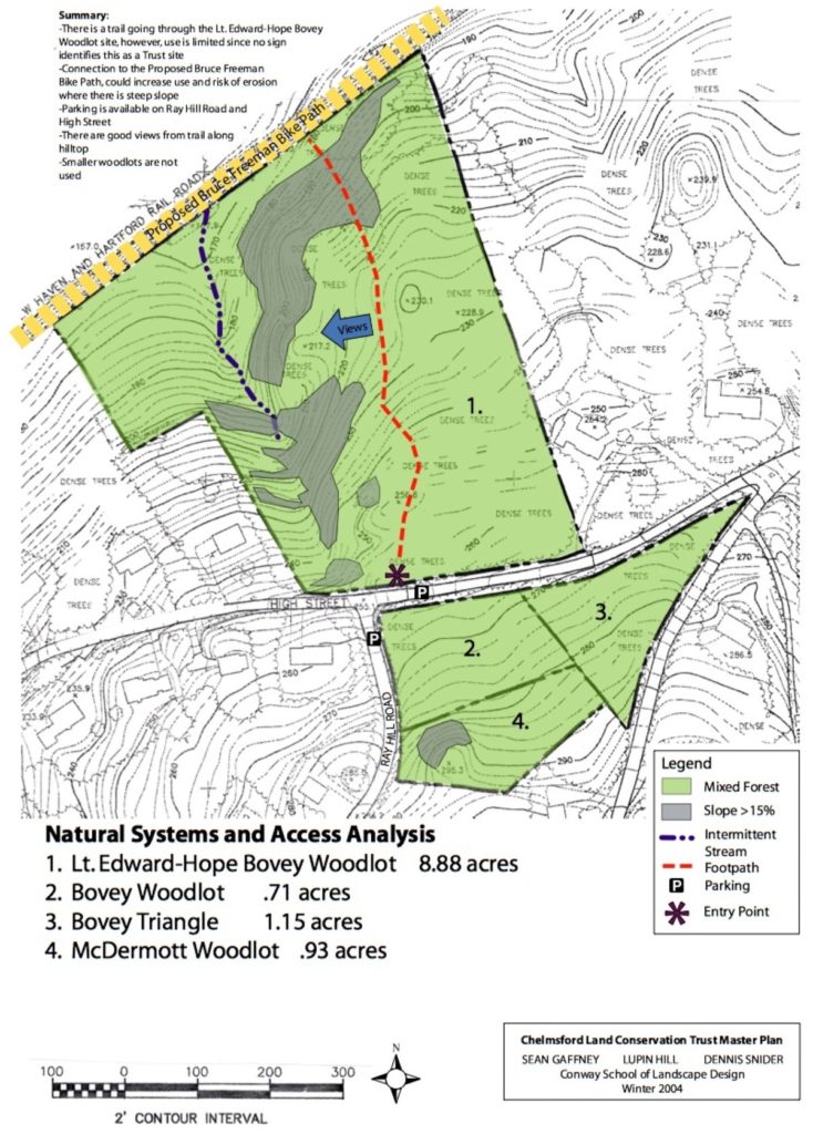
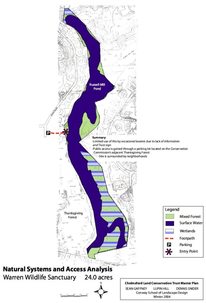
Trail Maps Get Out and Explore Maps for both Chelmsford Land Conservation Trust and other public land can be found below. Part of the Land Trust mission is getting resident to be involved with open space no matter who is the land owner.LocationsChelmsfordAddressTrail Map (Click to open)Owner*Thanksgiving ForestSouth40 Janet RdThanksgiving ForestConComWestlands’ Cynthia Moore’s Nature ParkCentral100 Dalton RdWestland’s Nature ParkCSDDeep BrookNorth124 Dunstable RdDeep BrookConComSunny Meadow FarmSouth168 Robin Hill RdSunny Meadow FarmTownSouthwell Nature TrailNorth1 Wotton StSouth WellTownGeorge B.B WrightSouth120 Parker RdGeorge B. B. WrightConComHeart PondSouth1 Pond StHeart PondTownLime QuarryCentral161 Littleton RdLime QuarryConComBartlett ParkCentral1 Bartlett StBartlett ParkCLCTCrooked SpringsNorth79 Crooked Springs RdCrooked-SpringConComRed Wing TreeSouth17 Maple RdRed Wing FarmConComOak HillNorth40 Swain RdOak Hill ReservationConComThe BogSouth60 Elm StThe BogConComHope Bovey Wood LotCentralHigh St and Ray HillBovey Hope Wood LotCLCTVarney ParkNorthAdams and Grant StVarney ParkTownKroll, Calder, Larter PastureSouth44/46 Proctor RdKroll, Calder, Larter PastureCLCTSouthWell RiverwalkNorth1 Wotton StSouth WellTownBartlett WoodlotCentral27 Acton RdBartlett Wood LotCLCT *Owner key:ConCom = Chelmsford Conservation CommissionCLCT = Chelmsford Land Conservation Trust – That’s us!CSD = Chelmsford School DepartmentTown = Town of Chelmsford, town manager Archer Meadowbrook Preserve Bartlett Park Bartlett Woodlot Bovey Woodlots Warren Wildlife Sanctuary